


“. . . we might describe Chile as a pleasant and delightful realm and, from whatever point of view we look at it, we can call it an earthly paradise.”
The Journals of Hipolito Ruis, Spanish Botanist in Peru and Chili 1777-1788, translated by Schultes and Jaramillo-Arango
The long, narrow country of Chile stretches 2,672[1. Measurements were originally provided in metric; when translated into English equivalents, they may seem uncommonly precise.]miles along the western coast of southern South America, comparable to the distance in North America from southern Alaska to the tip of Baja California, yet it is barely 124 miles at its widest point. Part of the Ring of Fire, Chile is seismically active, with a chain of over 125 volcanoes scattered along the country’s eastern border formed by the Andes cordillera. The world’s tallest active volcano, Nevada Ojos del Salado (22,664 feet), straddles the border with Argentina, and the continent’s highest peak, Cerro Aconcagua (22,831 feet) rises northeast of Santiago, just over the border. The Andes gradually decrease in height south of Santiago to just over 3,281 feet at Tierra del Fuego. The discontinuous Cordillera de la Costa runs the length of the coast, continuing as the coastal islands in the southern part of the country. This coastal range rarely exceeds 5,000 feet, high enough to form a barrier to air and moisture movement inland from the ocean. Sandwiched between the two ranges is a long narrow valley stretching the length of the country, as far south as Puerto Montt.
Habitats and Flora
Chile features environments that can be broadly categorized into five main zones, from north to south: the essentially rainless Atacama Desert in the north, the semi-desert immediately south of the Atacama, the mediterranean central section with winter rainfall, the temperate rain forest with a less pronounced summer drought, and the wet south with year-round rainfall. (The Andean alpine zone is a sixth zone that runs the full length of the country.) The long, narrow central valley is too dry to support permanent plant cover in the north and has been altered by humans in the south to the extent that little natural vegetation remains. The Atacama Desert is the world’s driest desert, some parts of which have not received any measurable rainfall in recorded history. In contrast, the far south is among the coolest, rainiest regions in the world (some areas exceeding 200 inches annually),and glaciers form the backdrop to seemingly endless expanses of wet meadows.
Nearly 4,300 species of vascular plants occur in Chile’s diverse habitats, of which forty-five percent are endemic, a rate that can be attributed to Chile’s isolation by ocean, desert, and mountains. The flora of northern and central Chile is mostly derived from Neotropical elements and, to a lesser extent, Gondwanan ones, while that of southern Chile is primarily of Gondwanan origin. Several genera are shared as disjuncts between Chile and western North America, among them Clarkia, Encelia, Larrea, Mentzelia, Mirabilis, Perityle, and Prosopis, as well as over 100 (mostly herbaceous) species. As South America was once a piece of the great southern supercontinent Gondwana, southern Chile shares many plant genera with New Zealand and Australia. Among the conifers, these include Araucaria, Podocarpus, Lepidothamnus, and Prumnopitys; among broad-leaved plants, Caldcluvia, Lomatia, Nothofagus, Pseudopanax, and Weinmannia. Sophora microphylla occurs in both Chile and New Zealand.

Climates from North to South
In general, Chile’s climate is cool, with relatively small diurnal and seasonal temperature fluctuations, particularly along the coast. The Humboldt Current brings cold sub-antarctic water northward and, along with the near-shore upwelling of even colder water (which cools and dries the air that passes over it), forms a year-round thermal inversion (warm air over cold dry air) that keeps temperatures on the coast low. The cold air mass extends to the Andes and, combined with the tall bulk of the cordillera, blocks warm, moist continental air from the east. A persistent, high-pressure anticyclone belt sits just north of 30° S latitude in summer, blocking storms from the west; the counter-clockwise rotation and accompanying subsidence of the air mass pushes cold dry air over the land. A double rainshadow thus exists in the northern parts of the central valley.
Rainfall is rare or absent in the northern desert, falls in summer over the Andean Altiplano (as far south as the Tropic of Capricorn), falls during winter in the central mediterranean region, and occurs evenly year-round in the far south. In some years, the ocean is unusually warm, causing the “El Nino” effect of high rainfall in Chile—and California. In winter, a large fog bank sits against the northern coastal mountains (often persisting for days or weeks), usually below the inversion layer, and extends far out to sea. In summer, the fog forms higher up and farther offshore and is blown onshore by the morning sea breeze, usually dissipating by midday. The inversion layer inhibits the upward movement of air and water vapor, so that, even under clear skies, the coastal air is quite humid.
Although it is warmer on the inland side of the coastal mountains, their relatively low and discontinuous relief and the proximity of the cold ocean moderates temperatures in Chile’s narrow interior; the country’s average maximum temperature in the warmest month (January) is 86°F and readings over 100°F are rare. Chile is generally cooler than California at similar latitudes and distances from the ocean. For example, the mean annual temperature at Santiago (33° S) is 57°F, at Pasadena (34° N), 62.2°F. This is due partly to the slightly higher elevations of the Chilean interior compared with corresponding locations in California, but mainly to the smaller landmass of southern South America (thus, less heating of the land) and the colder water of the Humboldt Current than that of the California Current. The Andes are 150 percent of the height of the Sierra Nevada and create a greater barrier to warm continental air in summer. Opposite of the usual trend of higher temperatures equatorward, northern Chile is generally cooler than the south, and Chile’s warmest temperatures typically occur in the central valley south of Santiago.
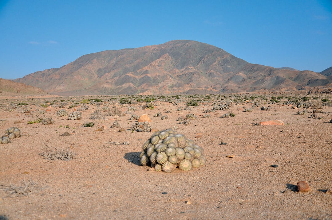
The Driest Desert
The desert along South America’s Pacific Coast begins near the Ecuador-Peru border and stretches roughly 2,000 miles south to Copiapo (27° S) or La Serena (30° S) in Chile (the southern boundary is not universally agreed upon), and eastward to the Andes. Like Baja California and the Namib in southern Africa, it is mostly a cold coastal desert dependent on moisture from fog.
The Atacama is the Chilean portion of this desert. Chile’s coastal mountains prevent fog from penetrating inland (though ground fogs can occur here), so the interior is effectively in a “fog shadow” and is generally much warmer than the coastal region. Summer temperature averages are 78°F on the Atacama coast and 85-90°F inland. Parts of the Atacama are completely devoid of life (except for a few species of bacteria), but a few rivers flowing westward from the Andes have enough volume to support an adjacent belt of greenery. A remarkable vegetal feature of the Atacama is the Pampa de Tamarugal, an open woodland on saline soil whose sole component is a mesquite (Prosopis tamarugo). Many trees of this formerly vast woodland were cut down to supply fuel for the nitrate mines that were once the mainstay of the region’s economy. The seed pods offer protein-rich forage for goats, and replanting by local people has artificially sustained the present stands, although the trees still face numerous threats. In a region where the average rainfall is less than 0.04 inches per year, the tree’s presence is made possible by roots able to reach an underground aquifer as deep as forty feet.
The Lomas
A unique vegetation type found in the Peruvian-Chilean desert and semi-desert is the lomas (“low hills”) formation. These “fog oases” occur on the steep seaward slopes upon which the fog (called camanchaca in Chile) condenses in a zone typically between 656 and 2,624 feet elevation. Each loma is a unique island community, and two of Chile’s most well-known and studied ones are in Parque Nacional Pan de Azucar and Parque Nacional Bosque de Fray Jorge. An important source of moisture for supporting plant life, the condensed fog has also been exploited for human benefit. At Pan de Azucar, fog collecting nets were, for years, the main source of drinking water in the park; each collector was able to condense about half a gallon of water per cubic meter. In the 1990s, an experimental fog collection system at El Tofo, north of La Serena, used large vertical nylon mesh collectors that condensed and stored an average of 3,963 gallons of water per day, initially for a reforestation project and later to supply the local town with water.
The flora of Pan de Azucar includes over 200 species, forty percent of which are drawn from only five plant families: Asteraceae (daisies), Nolanaceae, Cactaceae, Poaceae (grasses), and Boraginaceae. Perhaps surprisingly, the greatest diversity is in the arid coastal habitats, below the fog zone, that intercept rainwater runoff from the slopes above. Here occur such plants as Argylia radiata, Copiapoa cinerascens, and Skytanthus acutus, as well as many ephemerals in seasons of good rainfall. Euphorbia lactiflua, Nicotiana solanifolia, Alstroemeria violacea, and Leucocoryne appendiculata are among the species occurring within the fog zone.
Fray Jorge supports the northernmost remnant of a Valdivian type of moist forest (about which, more later), vegetation more typical of much farther south that presumably existed over more of Chile in the past, when the climate was wetter. In an area that receives only six inches of annual mean rainfall, the small forest atop the steep coastal escarpment creates its own precipitation—up to sixty inches annually—by condensing the fog, which runs down to the ground and supports not just the trees but a rich herbaceous flora beneath. Characteristic Valdivian species such as Aextoxicon puncta-tum, Azara microphylla, Griselinia scandens, and Nertera granadensis are not seen again for 777 miles southward.

The Norte Chico
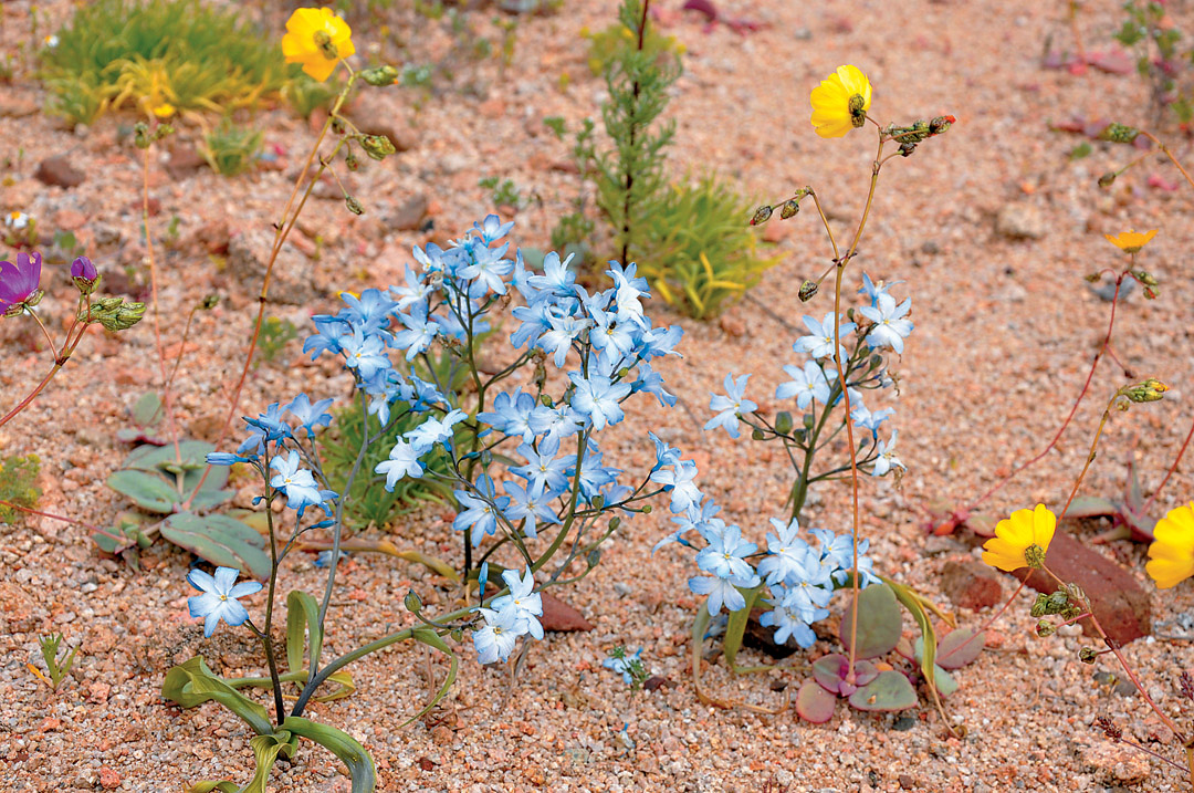
The semi-desert area known as Norte Chico includes the administrative regions of Atacama (which only partly coincides with the eponymous desert) and Coquimbo, from about 26° S to 32° S latitudes. Although the rainfall, when it comes, occurs in winter, the annual average of less than four inches places this region in a “too-dry” sub-mediterranean climate zone. This is the setting for the Desierto Florido (“flowering desert”), which occurs about every five to ten years with sufficient winter rainfall. Not much is needed: only about 0.6 inches to trigger germination and 1.4 to 2.2 inches to sustain growth. In a good year, annuals and geophtyes sprout from the seemingly barren land. Annuals, including Calandrinia, Cistanthe, Cristaria, and Nolana, and geophytes, such as Rhodophiala bagnoldii and Zephyra elegans, form vast monochrome or mixed carpets of color. Except along the coast, permanent plant cover in this area is absent or sparse, typically composed of cacti (Eulychnia acida), low shrubs (Cordia decandra), and perennials (Encelia canescens). One of the genera in this area (as well as in the northern desert) that seems unexpected is Heliotropium; the common fragrant garden heliotrope (H. arborescens) does not conjure images of the many species in Chile’s arid regions. Parque Nacional Llanos de Challe, another of the lomas, protects a rich coastal desert vegetation of over 200 species, fourteen of which are endemic. One of Chile’s most renowned (and endangered) plants, the garra de león (Leontochir ovallei), occurs only here and a few areas nearby. Among the most common perennial plants are shrubs such as Balbisia peduncularis, Oxalis gigantea, the herbaceous Argylia radiata, a white-flowered form of the succulent Cistanthe grandiflora, and various cacti.
The Mediterranean Center
The mediterranean climate type occurs in five regions: the Mediterranean Basin and adjacent Atlantic Iberia, Morocco, and Canary Islands; the southwestern tip of South Africa; southwestern and south-central Australia; California and northern Baja California (from about 40° N to 30° N latitudes); and central Chile. They all share four key climatic characteristics: rainfall concentrated in the winter half-year (the most important factor), dry (and usually hot) summers, moderate winters (frosts are uncommon), and the regular, reliable alternation of the warm, dry summer with the cooler, rainier winter seasons. The stable atmospheric high-pressure belts that sit at 30° N and 30° S latitudes are displaced equatorward in winter, allowing the westerlies to deliver moisture-laden storms. With the exception of Australia, fog is frequently present, and, with the exception of Chile, the vegetation is adapted to fire. Occupying only about two percent of the earth’s land surface, but with twenty percent of the world’s vascular plants, the mediterranean flora is extremely diverse, and the vegetation is primarily open sclerophyll woodland, shrubland, and scrub. Chile’s mediterranean-climate region includes an estimated 1,800-2,400 species and has among the highest rates of endemism in South America.
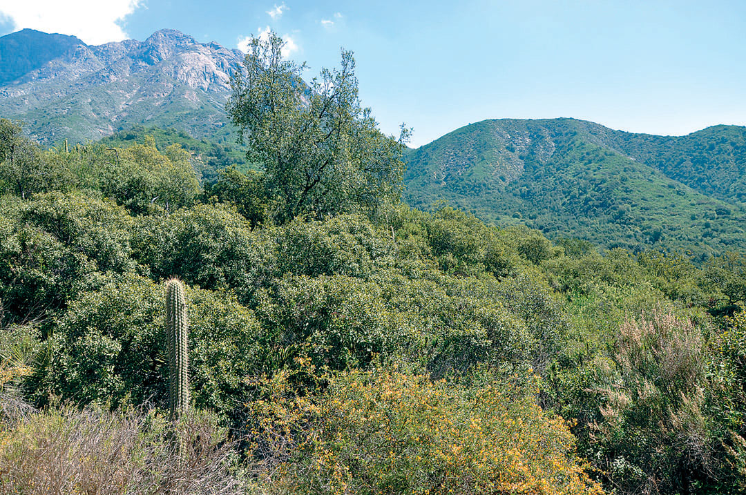
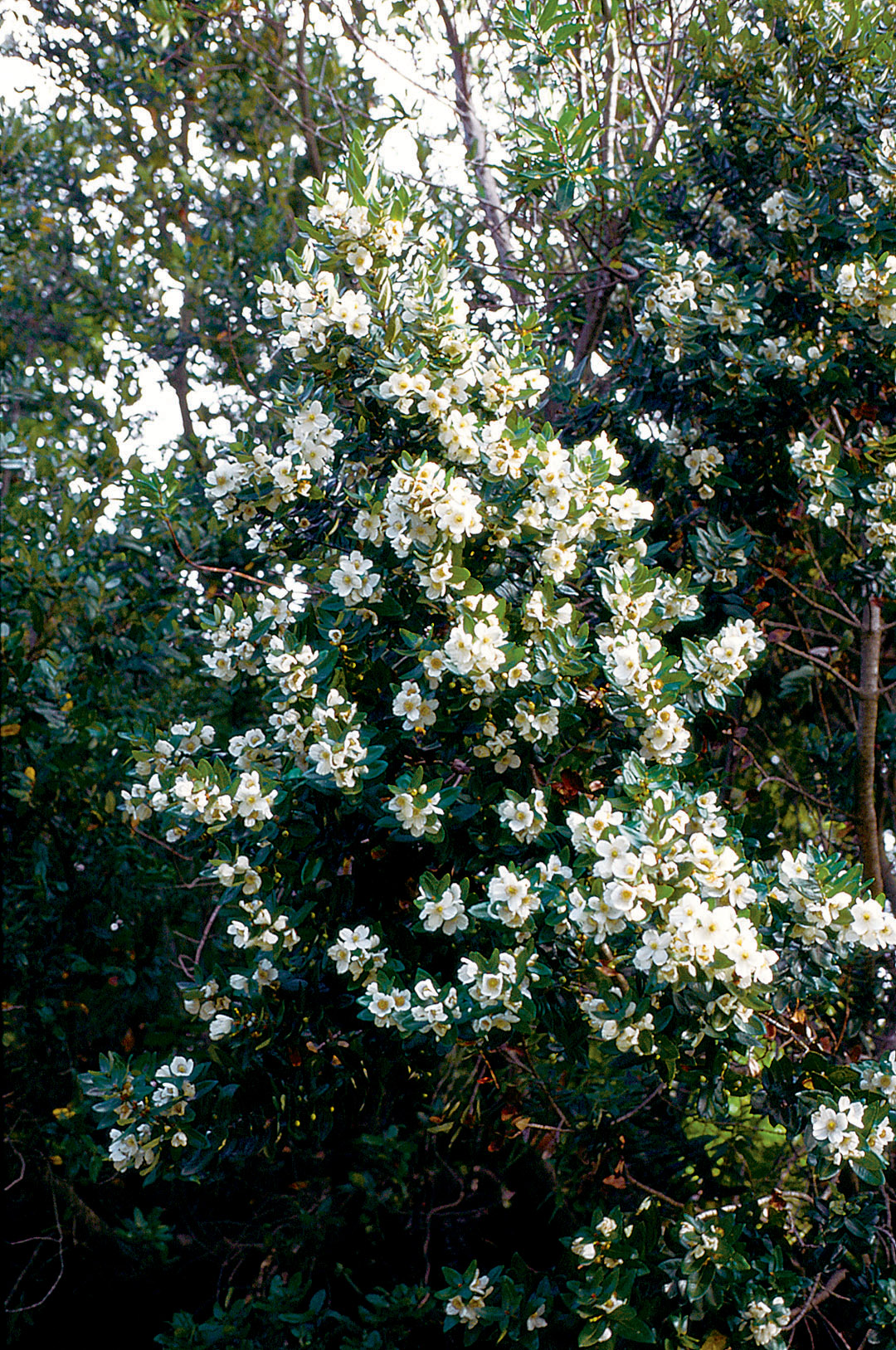
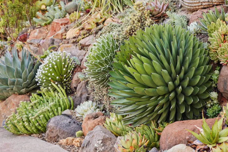
In Chile, the mediterranean climate zone is between 32° S and 37° S latitudes, from just south of La Serena to just south of Concepción, with annual rainfalls averaging 11.8 to 31.5 inches. Rainfall averages twenty inches at Valparaiso on the coast and fourteen inches at Santiago in the central valley; the highest recorded temperatures at each city are 94°F and 95°F respectively. In Chile, the shrubland vegetation is known as matorral and, in many ways, is so similar to the analogous California chaparral that entire books have been written on the subject. Differing from California’s chaparral is the occasional presence of a palm (Jubaea chilensis), arborescent bromeliads in the genus Puya, and columnar cacti such as Trichocereus chiloensis. The herbaceous cover is also greater in matorral than in chaparral and is mostly composed of perennials (primarily geophytes) rather than annuals. A particularly good place to see several mediterranean vegetation types together is Parque Nacional La Campana.
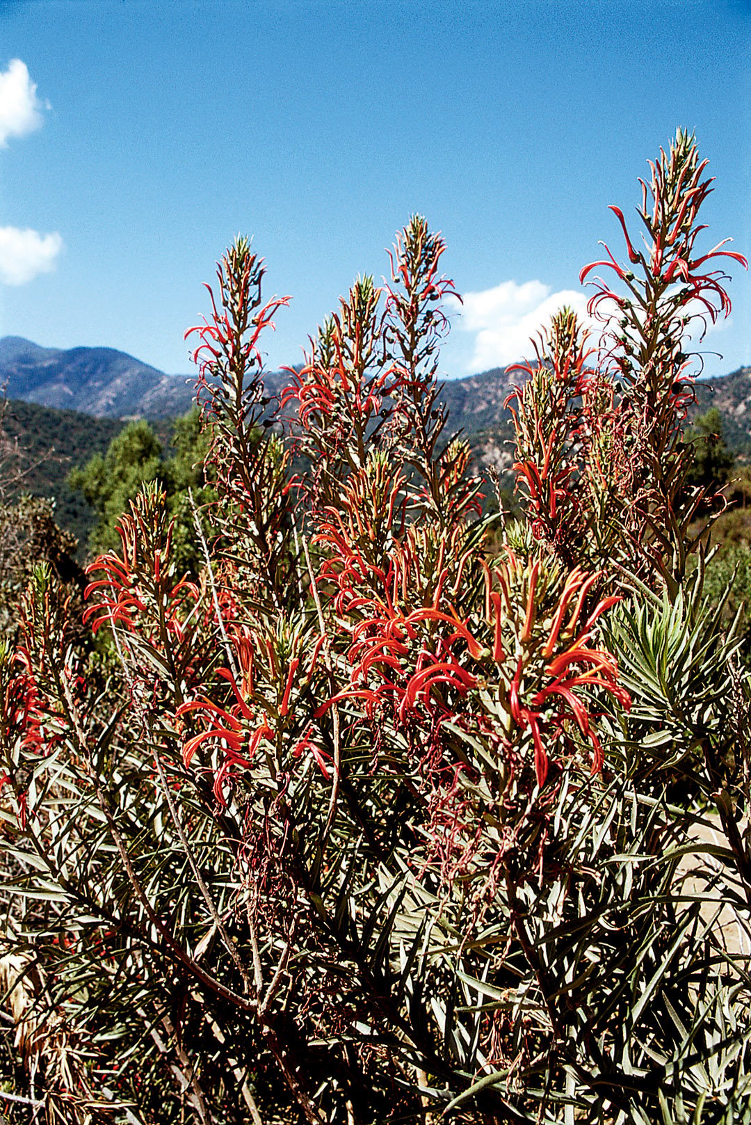
The Chilean area of matorral is relatively small, extending up to about 4,921 feet elevation, giving way higher up to montane matorral and alpine vegetation. Moist seaward slopes within the matorral region can be clothed in a humid forest (bosque laurofilo), with species such as Crinodendron patagua and Beilschmeidia miersii. Chile’s coastal matorral corresponds to California’s coastal sage scrub and includes low shrubs, such as Fuchsia lycioides and Lobelia polyphylla, and taller ones, such as Escallonia pulverulenta, Puya chilensis, and P. venusta. The sclerophyll woodland (bosque esclerófilo) is similar to California’s oak woodlands; a typical tree of the bosque is boldo (Peumus boldus), which appears strikingly similar in the landscape to California’s coast live oak (Quercus agrifolia). Other characteristic matorral species include Cryptocarya alba, Lobelia excelsa, mayten tree (Maytenus boaria), and soapbark tree (Quillaja saponaria).
Temperate Rain Forests
South from Concepción, as the duration of summer drought decreases and annual rainfall increases to more than forty inches, the Neotropical plants give way to Gondwanan or Holantarctic elements (though Neotropical elements such as Puya are still present). The mediterranean vegetation transitions to warm-temperate mixed evergreen/deciduous forest with southern beeches (Nothofagus) and the first of the nine southern conifers (Austrocedrus chilensis); due to extensive clearing for agriculture, little primary forest remains at lower elevations outside of national reserves. The ten Chilean species of Nothofagus (of which seven are deciduous) are the dominant forest trees for 1,243 miles southward from about 38-39° S latitude. Shrubs, such as Fabiana imbricata and Sophora macrocarpa, can be seen in drier, more open sites.
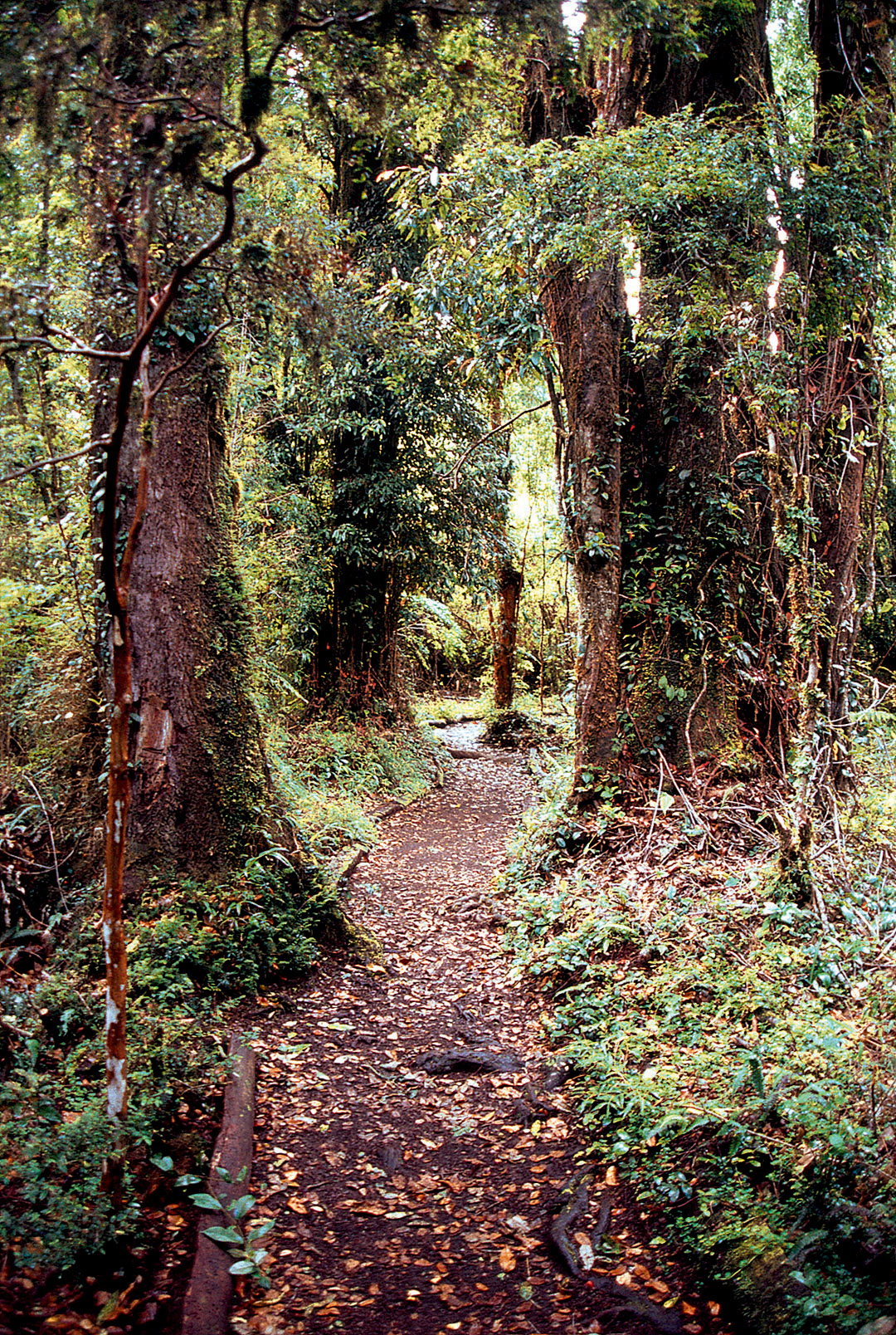

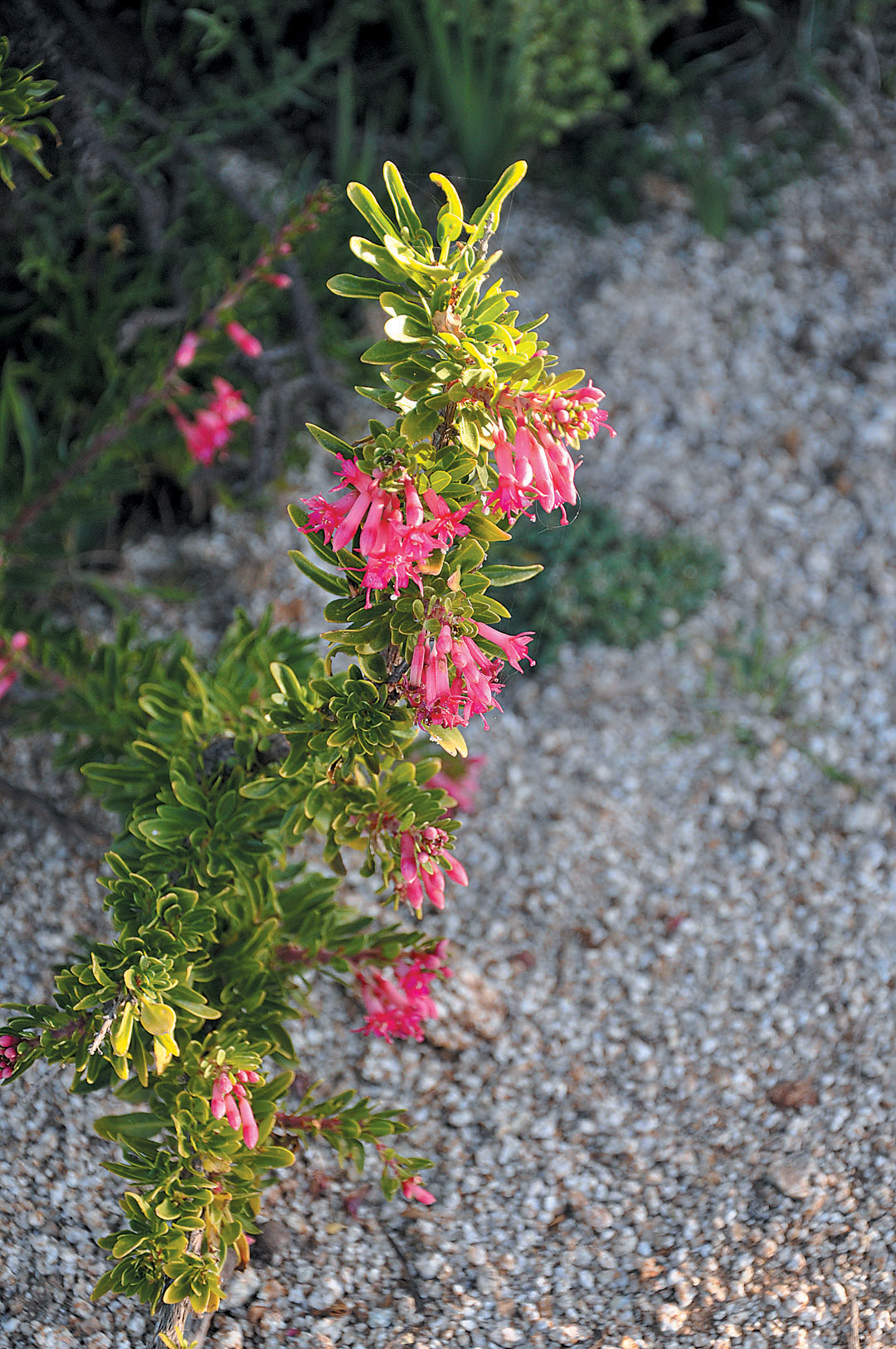
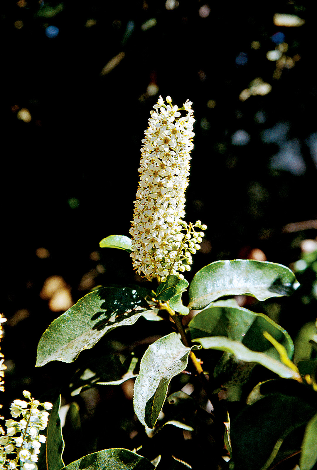
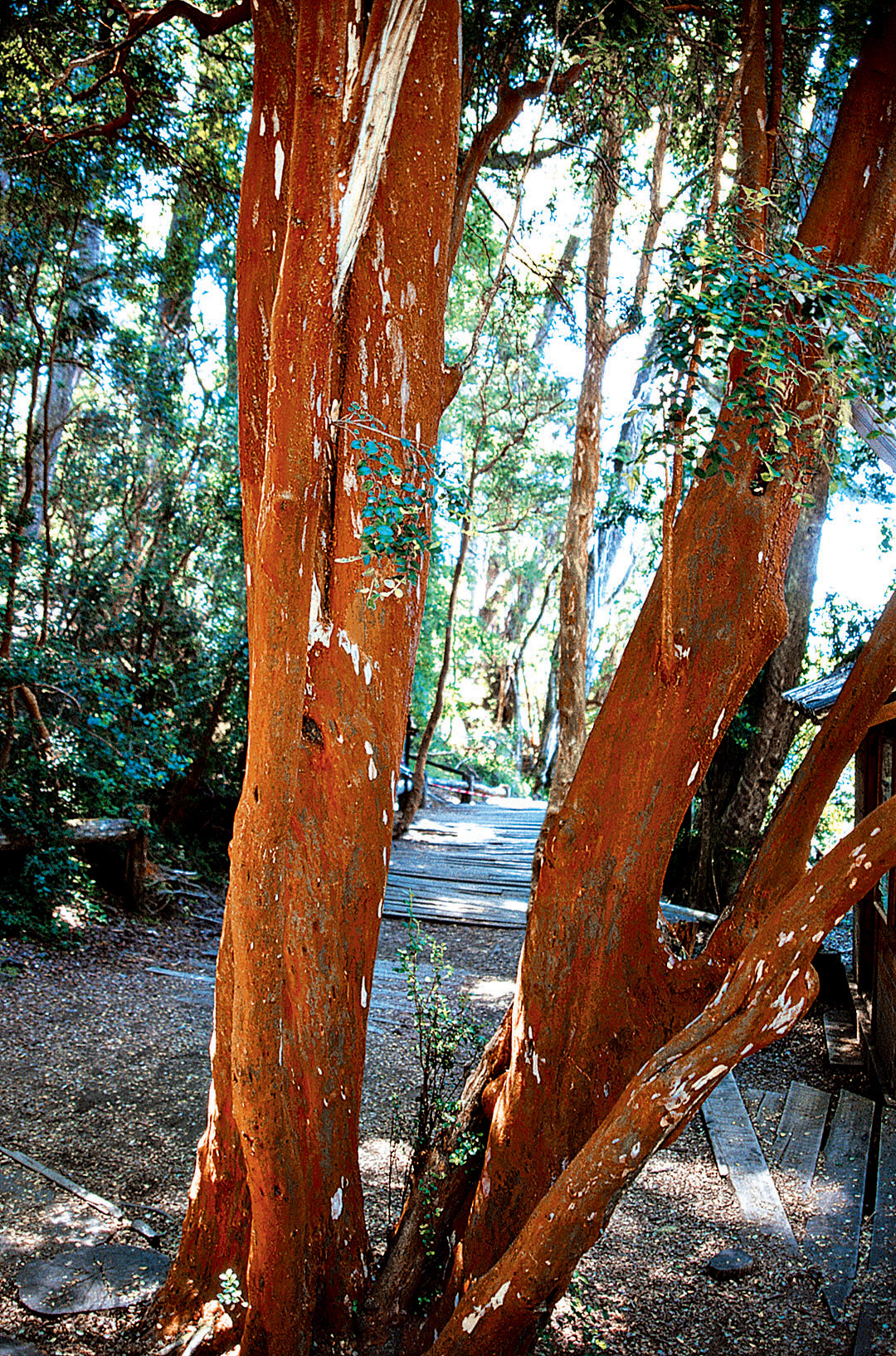
Along the Andes from Valdivia to the Strait of Magellan is the zone of the Valdivian, Patagonian, and Magellanic temperate rain forests, the world’s second most extensive after those of the Pacific North-west. Here, the annual precipitation can exceed 78.7 inches; south of 50° S latitude, its seasonality disappears. Dominated by southern beeches and the southern conifers, the most notable forest tree here is the iconic pehuén or monkey puzzle tree (Araucaria araucana), often forming majestic stands. The other noteworthy forest conifer is alerce or Chilean redwood (Fitzroya cupressoides), which occurs in the coastal mountains south of Valdivia and in the Andes south from near Puerto Montt. Broadleaved upper canopy trees (other than Nothofagus) include Aextoxicon punctatum, winter’s bark (Drimys winteri), Eucryphia cordifolia, and Luma apiculata; in the lower canopy are found Crinodendron hookerianum, Chilean firebush (Embothrium coccineum), Gevuina avellana, and Pseudopanax laetevirens. The dense understory may include Desfontainia spinosa, Fuchsia magellanica, and copihue, Chile’s national flower (Lapageria rosea). Climbing bamboos (Chusquea culeou and C. quila) can reach forty feet tall and often cover all in their path.

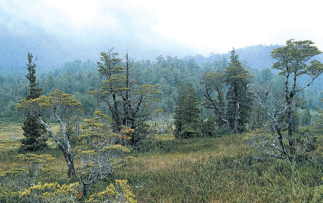
The Wet South
South of Puerto Montt, the climate becomes cooler and wetter (157 inches annually south of 47° S latitude), and the Valdivian forests transition to Patagonian and Magellanic forests dominated by Nothofagus, particularly N. pumilio, which covers perhaps the largest land area of all the world’s southern beeches. The conifer Pilgerodendron uviferum is common in poorly drained, constantly wet areas. Gunnera tinctoria forms a tunnel over long stretches of the main southern highway (Carratera Austral). The forests decrease in height and become less diverse farther south, eventually giving way to endless expanses of moorland and sphagnum bog with Acaena pumila, Empetrum rubrum, and Philesia magellanica, among others. Although the climate is considered (ant)arctic, with primarily oceanic rather than continental influence at the narrow tip of the continent, frosts are rare and the vegetation is evergreen, kept low by the constant strong winds at this latitude. This is the home of the world’s southernmost conifer, the dwarf Lepidothamnus fonkii, which reaches as far south as 55° S latitude near the tip of the continent; on wet boggy soils, it can carpet hundreds of contiguous acres.


Ground Up Science for Greener Cities with Garden Futurist Dr. Alessandro Ossola
Spring 2023 Listen to the Podcast here. Alessandro Ossola is a scientist who gets very excited about the challenge of climate change allowing for an
Readying Urban Forests for Climate Realities with Garden Futurist Dr. Greg McPherson
Winter 2023 Listen to the Podcast here. “Going from the mow and blow to a more horticulturally knowledgeable approach to maintaining the landscape. And that
Low Maintenance Gardens – Better for Pollinators and People
Autumn 2022 “I come out every day. It’s therapy, my meditation.” Janet’s young garden transformed from overgrown, invasive plants to mostly natives. The dailiness of
Invasive Plants Are Still Being Sold: Preventing Noxious Weeds in Your Landscape
Autumn 2022 With so many beautiful ornamental plant species and cultivars throughout California and the Pacific Northwest, how do you decide which ones to include
Responses